
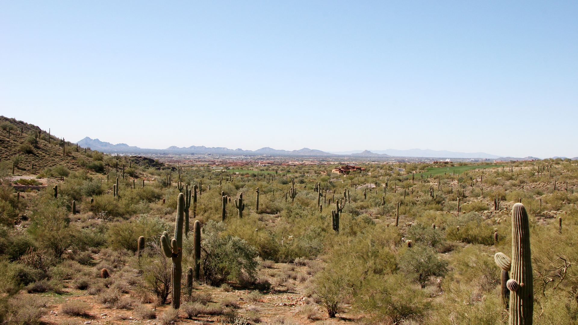
The first week of November 2026 put water where a lot of people do not expect it. I am not using that storm to scare anyone off a desert lot. I am using it as the reason to run the same checklist I already use in Silverleaf, DC Ranch, Troon North, and Desert Mountain, whether or not it rained that week.
What the Early November Storms Showed
AZFamily reported on November 2, 2026, that floodwaters covered roadways and walking paths near Hayden and Chaparral roads on Monday morning, and that the water reached the walls of a nearby gym. The same report said one person was rescued Sunday evening. Scottsdale and Phoenix crews were called to the Terravita neighborhood, near Scottsdale and Westland roads, around 7:30 p.m. Firefighters said a person was trapped in a vehicle after driving through a flooded wash. They got the driver out.
Scottsdale Fire Capt. Dave Folio told AZFamily to follow "Turn Around, Don't Drown." He said not to drive through flooded roadways or washes, not to go around barricades, and not to assume a wash is safe because the water looks shallow. He also said residents should not walk, swim, or play in moving floodwater. His statement, as AZFamily quoted it: "Just a few inches of moving water can cause you to lose control of your vehicle." That is a warning about a road and a wash. It is not a claim about any one listing. The checklist below is how I find out what a specific lot is actually sitting on.
How to Check the FEMA Flood Zone
Start with the address, not with a guess from the street name. The FEMA Flood Map Service Center is the official public source for flood hazard information produced for the National Flood Insurance Program. Use it to find the official flood map for the property. FEMA says those maps are updated, and that a map you download or print can be replaced later. Save the date you looked, and look again before you remove an inspection contingency.
The Flood Control District of Maricopa County describes how to read what you find. A floodplain delineation study maps land that can be inundated by a flood with a 1% chance of being equaled or exceeded in any given year, also called a 100-year flood. On a Flood Insurance Rate Map, a Special Flood Hazard Area is the shaded area with that same 1% annual chance. The district says a lender uses the FEMA map to decide whether the property is in a 100-year floodplain, and that if the lender makes that determination you are required to purchase flood insurance. The lender's determination locates the property in or out of the floodplain. It does not measure whether the house sits above the water elevation.
If you disagree with the lender, the district says you may request a Flood Hazard Determination Review from FEMA. The request has to be postmarked no later than 45 days after the lender notifies you of the insurance requirement, and it has to include the information and fees FEMA requires. A separate path is a Letter of Map Amendment. The district says that if the lot or building site is on natural ground higher than the base flood elevation on the map, you may request a LOMA, which includes an elevation certificate. If FEMA approves it, the letter verifies that the building, or part of the property, has been removed from the designated floodplain, and the lender may then choose not to require flood insurance. I am not quoting an insurance price. Ask the lender and the insurance agent for the number on this property.
A clear map is not a promise that the lot cannot flood. The district says floodplains exist in areas that have not been documented by a study yet, and that the limits can change because of a flood or because of development. It also says new habitable construction in a mapped floodplain has to be built so the lowest floor is above the base flood elevation. Habitable, in the district's words, means floors with living areas on them. For a house already standing, the question I want answered is whether this building was held to that line, not whether a blank spot on the map feels dry.
Who Regulates a Scottsdale Lot
Scottsdale does not leave this to the county by default. The Flood Control District's floodplain page says the district regulates unincorporated Maricopa County and a list of towns, and then it lists the cities that conduct their own floodplain management. Scottsdale is on that second list, with the phone number 480-312-2356. For a house inside the city, I call Scottsdale and I still open the maps.
The district will still do a flood hazard lookup. It says there is no fee. You submit a Flood Hazard Information Request and a district representative sends back the zone and the map panel. The Floodplain Management and Services Division number on that page is 602-506-2419. The district's older Floodplain Viewer address now says the viewer has moved, and it points to the Floodplain and Elevation Certificate viewer. The district's floodway and floodplain guidance says to search that viewer by the assessor parcel number, then open the layers and legend to see whether the parcel is in a floodplain or a floodway. That same sheet repeats that Scottsdale runs its own floodplain management.
The city's floodplain management page is the local stack: alternate routes during flooding, real-time wash flow and rainfall, the stormwater and floodplain ordinance, the design standards manual, and the Homeowner's Guide to Drainage. The page lists the Stormwater Group at 480-312-7740. The drainage and flood control fact sheet says to contact Stormwater Management staff at 480-312-2500 with a specific question, and it says the sheet is an overview, not the ordinance. Use the number printed on the page you are reading. The ordinance itself is Chapter 37 of the Scottsdale city code.
What Scottsdale Says About Washes and ESL
North Scottsdale lots often sit in the Environmentally Sensitive Lands area, and a wash there is not just a landscaping feature. The city's ESL page says the overlay covers 134 square miles of desert and mountain land north and east of the Central Arizona Project canal. It requires a share of each property to be kept as natural area open space, and it calls out vegetation, washes, mountain ridges, and peaks as features to protect. The NAOS percentage depends on the landform and the slope. The table is on that page. I do not recite it as the answer for one lot. I ask what NAOS is already dedicated on the parcel.
The fact sheet, which the city updated September 29, 2026, states the rules I rely on when I am talking with a buyer. It says the sheet is an overview and is not the regulation. These are the points it actually states:
- Runoff should enter and leave a property after development in substantially the same manner as before development.
- Inside the ESL area, the fact sheet says the 100-year floodplain of a watercourse with a 100-year peak discharge of 50 cubic feet per second or greater has to be dedicated to the city by a drainage easement and kept in a natural state, unless a wash modification permit is obtained.
- Outside the ESL area, the same fact sheet says drainage and flood control easements are required for watercourses with a 100-year peak of 25 cubic feet per second or greater. Those watercourses are not required to stay natural.
- Generally, new development in the city has to provide stormwater storage. The fact sheet says the basins offset the extra runoff from development so the flood risk does not rise on properties downstream. It also says master-planned communities are subject to the same ordinance.
- Access has to be provided for lots in a development during the peak of the 100-year flood. The fact sheet says access exists if the depth of flow over the road does not exceed one foot.
- A watercourse may not be altered unless a professional civil engineer certifies that the change will not increase flood levels or flood hazards within the altered stretch, or upstream or downstream of it. Blocking a watercourse, or reducing its capacity by filling, dumping, or building, is prohibited.
- Building in a wash is generally discouraged, and the fact sheet says it is prohibited by ordinance in most situations.
- The fact sheet says the ESL ordinance also classifies watercourses as major, more than 750 cubic feet per second, and minor, between 250 and 750 cubic feet per second, for planning purposes.
A wash modification permit is not a formality. The fact sheet says an applicant has to demonstrate hardship, minimizing disturbance, a context-sensitive design, and revegetation plans, and the Zoning Administrator has to approve it. The ESL page says the goal is to leave washes in place and in natural condition where practical, and that a modification also has to meet Chapter 37 and the city's Design Standards and Policy Manual. The application has to describe the other ways the watercourse could have been handled. The city's link for the "Interactive GIS map showing 50 CFS Flow Washes" goes to the parcel information map. The ESL landforms map is separate, at eservices.scottsdaleaz.gov. Open the parcel, then ask the city which layer applies to this lot. Do not assume a green wash on a marketing plan is the regulatory wash.
What to Ask About Disclosures and the Survey
I ask for the seller's property disclosure statement, the SPDS form used in Arizona resale sales, and I read the parts on drainage, flooding, roof leaks, and grading. I am not going to tell you a statute number I have not pulled up for this article. Ask your own agent which disclosures this contract requires, and then read them against the map.
The city's homeowner drainage guide tells an owner to examine the deed and title for disclosures and restrictions, and to look at the recorded plat for tracts and drainage easements, including who is supposed to maintain them. That is the list I give the title company: drainage easements, wash easements, and NAOS easements, marked on the commitment, not described from memory. Then I want a survey, or a site plan, that shows the wash, the easement, and the building pad on the same drawing. If those three are not on one page, I do not yet know whether the patio, the wall, or the guest casita sits in the flow.
What to Put on the Inspection List
The same homeowner guide is the question list I hand an inspector. The guide says a drainage problem is possible if any of these are true:
- Any part of the house is lower than the surrounding ground, so water cannot flow freely away from the house.
- The property is in a FEMA-mapped floodplain.
- A dedicated drainage easement is on or near the property.
- A natural wash, or a manmade channel, is on or near the property.
- A stormwater storage basin is on or by the property.
- Roof runoff cannot flow safely away from the house.
The guide also says to look for evidence of flow, such as erosion and debris, for ponding, such as overgrown vegetation and water-stained walls, and for drainage features such as grates and drainpipes. I add three questions that are questions, not city rules: where the gutters discharge, where the pool deck and the equipment pad send overflow, and whether a later patio or yard wall has turned the grade back toward the house. The rest of what I want an inspector to open up is in the home inspection guide. Drainage is one section of that visit, not a replacement for it.
If You Are Building, Not Just Buying
A vacant lot makes the wash question bigger, because someone is about to decide where the pad goes. On a Silverleaf canyon lot I already wrote about grading, monsoon flow, and retaining in what it takes to build there. Read that before you assume a flat pad can be cut wherever the view is best. Then use the builder interview to ask one specific thing: would a wash modification permit be required before anyone moves this wash, and what NAOS and drainage easement are already on the parcel?
The fact sheet says a watercourse with a 100-year peak of 50 cubic feet per second or greater inside the ESL area stays natural unless that permit is granted. A builder with a good record on a flat lot somewhere else in the Valley has not answered that question. Get the civil engineer's note in writing, the one the ordinance describes, before you fall in love with a floor plan that needs the wash to move.
If you are buying a finished home rather than a lot, pair this checklist with the price-band piece I posted the same day. A softer negotiation at the top of the market does not excuse a skipped wash review: Scottsdale is two markets by price band.
FAQ: Washes, Flood Zones, and Drainage
How do I know if a Scottsdale property is in a flood zone? Start with the FEMA Flood Map Service Center, the official public source for National Flood Insurance Program maps, and search the address. The Flood Control District of Maricopa County describes a Special Flood Hazard Area as the shaded area on a Flood Insurance Rate Map with a 1% chance of flooding in any given year. Scottsdale runs its own floodplain management, so confirm the city's reading of that lot too. The district lists the city at 480-312-2356.
What should I check about washes before buying a desert lot in North Scottsdale? Ask whether a wash crosses the lot or the road in, whether a drainage easement or a natural area open space easement is recorded, and whether the wash is one the city expects to stay natural. In the Environmentally Sensitive Lands area, the city's drainage fact sheet says the 100-year floodplain of a watercourse with a 100-year peak of 50 cubic feet per second or greater is dedicated by a drainage easement and kept natural unless a wash modification permit is obtained. Outside that area, the same fact sheet says easements are required at 25 cubic feet per second or greater, and those washes are not required to stay natural.
Does a clear FEMA map mean the lot cannot flood? No. The Flood Control District says floodplains exist in areas that have not been documented by a study, and that a map can change after development or after a flood. AZFamily reported on November 2, 2026, that storms put water over roads near Hayden and Chaparral and trapped a driver in a flooded wash near Scottsdale and Westland roads. A map is a starting point, not a promise that a wash will stay dry.
What does Scottsdale say about changing a wash? The city's fact sheet says a watercourse may not be altered unless a professional civil engineer certifies that the change will not increase flood levels or flood hazards within, upstream, or downstream of the altered stretch. Blocking or shrinking a watercourse is prohibited. A wash modification in the ESL area has to show hardship, limited disturbance, a context-sensitive design, and revegetation, and the Zoning Administrator has to approve it. The fact sheet also says this is an overview, not the ordinance itself. The ordinance is Chapter 37.
What should the inspection cover? Use the city's homeowner drainage guide as the question list: whether water can flow away from the house, whether the lot is in a FEMA floodplain, whether a drainage easement, wash, channel, or storage basin is on or near it, and whether roof runoff can get away safely. Look for erosion, debris, ponding, and stained walls. Ask where the gutters and the pool deck send water. The longer inspection list is in the home inspection guide.
Who do I call about a Scottsdale floodplain question? The Flood Control District says Scottsdale conducts its own floodplain management and lists 480-312-2356. The city's floodplain management page lists the Stormwater Group at 480-312-7740. The drainage fact sheet says to call Stormwater Management staff at 480-312-2500 with a specific ordinance question. There is no fee for a district flood hazard lookup, and the district's number for that division is 602-506-2419. Use the number printed on the page you are reading, and ask the title company about recorded easements before you rely on a phone answer. You can also call me at (602) 622-1226.
Author Bio
Darren Tackett is the founder of The Tackett Team at eXp Realty, at 20551 N. Pima Road, Suite 185, Scottsdale, AZ 85255. On a desert lot I want the wash, the easement, and the pad on one drawing before anyone talks about the view.